
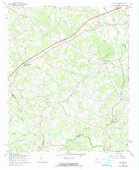
1964 Map of Ashland
USGS Topo · Published 1965About this map
The Hudson River and its numerous tributaries, including Nails Creek and Carlan Creek, carve through the rolling landscape of Franklin County in the mid-1960s. This survey illustrates a rural community defined by its watercourses and small crossroads settlements such as Ashland and Cromers. The intricate network of local country roads connects several small churches that served as the social anchors of the era, including Arnold Chapel, Indian Creek Ch, and Ebenezer Ch.
Find a feature on this map
29 named features on this map. Tap any name to fly to it.
Don’t see what you’re looking for? This feature index may not catch every label — zoom into the map to look around manually.
Map Details
Editions of this 1964 Ashland Map
2 editions found
Other maps of this area

1891 · Carnesville
USGS Topo · 1:125,000

1954 · Greenville
USGS Topo · 1:250,000

1958 · Greenville
USGS Topo · 1:250,000

1958 · Danielsville
USGS Topo · 1:62,500

1959 · Carnesville
USGS Topo · 1:24,000

1960 · Martin
USGS Topo · 1:24,000

1964 · Commerce
USGS Topo · 1:24,000

1964 · Ila
USGS Topo · 1:24,000
1964 · Lake Russell
USGS Topo · 1:24,000
1964 · Red Hill
USGS Topo · 1:24,000