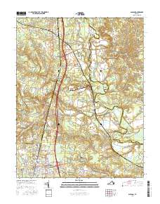
2016 Map of Ashland
USGS Topo · Published 2016About this map
Ashland serves as the focal point of this Virginia survey, where the grounds of Randolph-Macon Coll meet the historic rail corridor. The landscape is defined by the convergence of several major watercourses, including the North Anna River and the South Anna River, which bracket the region's northern and southern reaches. To the north, Doswell and Taylorsville mark significant rural crossroads, while the boundary of the Caroline Co Hanover Co line weaves through the marshy lowlands of Bear Island.
Find a feature on this map
113 named features on this map. Tap any name to fly to it.
Don’t see what you’re looking for? This feature index may not catch every label — zoom into the map to look around manually.
Map Details
Editions of this 2016 Ashland Map
This is the sole edition of this map. No revisions or reprints were ever made.
Other maps of this area

1890 · Goochland
USGS Topo · 1:125,000

1892 · Goochland
USGS Topo · 1:125,000

1894 · Richmond
USGS Topo · 1:62,500

1895 · Richmond
USGS Topo · 1:62,500

1918 · Doswell
USGS Topo · 1:62,500

1936 · Glen Allen
USGS Topo · 1:24,000

1938 · Studley
USGS Topo · 1:31,680

1938 · Yellow Tavern
USGS Topo · 1:31,680

1941 · Glen Allen
USGS Topo · 1:31,680
1943 · Hanover Academy
USGS Topo · 1:31,680