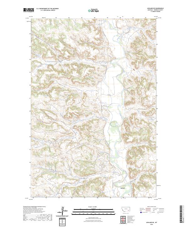
2024 Map of Ashland NE
USGS Topo · Published 2024About this map
Tongue River meanders through this portion of Rosebud County, serving as the primary drainage for a landscape defined by deep draws and winding coulees. The settlement of Ashland is positioned in the south, where the river valley widens and connects with Double E Coulee and Stebbins Creek. This 2024 survey captures a rural landscape where modern ranching routes like Greenleaf Rd and Tongue River Rd follow the natural contours of the land, tracing the same paths established by early transit corridors such as Wagon Trail Ln. The map also details several smaller tributaries, including Reservation Creek and Bringoff Creek, providing a contemporary view of the region's hydrography and public land divisions within t1s r43e and t2s r44e.
Find a feature on this map
25 named features on this map. Tap any name to fly to it.
Don’t see what you’re looking for? This feature index may not catch every label — zoom into the map to look around manually.
Map Details
Editions of this 2024 Ashland NE Map
This is the sole edition of this map. No revisions or reprints were ever made.
Other maps of this area

1954 · Hardin
USGS Topo · 1:250,000

1957 · Hardin
USGS Topo · 1:250,000

1958 · Hardin
USGS Topo · 1:250,000

1958 · Garfield Peak
USGS Topo · 1:24,000

1958 · Hollowwood Creek
USGS Topo · 1:24,000

1966 · Ashland
USGS Topo · 1:24,000

1966 · Cook Creek Reservoir
USGS Topo · 1:24,000

1966 · Willow Crossing
USGS Topo · 1:24,000

1966 · Ashland NE
USGS Topo · 1:24,000

1971 · Hammond Draw
USGS Topo · 1:24,000