
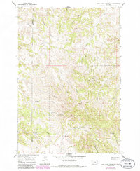
1966 Map of Cook Creek Reservoir
USGS Topo · Published 1969About this map
Custer National Forest land dominates this high-plains landscape, where the boundary between Rosebud and Powder River Counties bisects a terrain defined by complex drainages and essential water improvements. Cattle ranching and land management are evident through the network of named reservoirs and wells, such as the Shy Reservoir and the Colbert Coulee Well, which provided vital resources for livestock in this semi-arid region.
Find a feature on this map
27 named features on this map. Tap any name to fly to it.
Don’t see what you’re looking for? This feature index may not catch every label — zoom into the map to look around manually.
Map Details
Editions of this 1966 Cook Creek Reservoir Map
2 editions found
Other maps of this area

1954 · Hardin
USGS Topo · 1:250,000

1957 · Hardin
USGS Topo · 1:250,000

1958 · Hardin
USGS Topo · 1:250,000

1966 · Coleman Draw
USGS Topo · 1:24,000

1966 · Ashland
USGS Topo · 1:24,000

1966 · Beaver Creek School
USGS Topo · 1:24,000

1966 · Willow Crossing
USGS Topo · 1:24,000

1966 · Ashland NE
USGS Topo · 1:24,000

1971 · Hammond Draw
USGS Topo · 1:24,000
1971 · Hayes Point
USGS Topo · 1:24,000