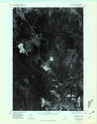
1975 Map of Ashland NW
USGS Topo · Published 1981About this map
The town of Ashland serves as the focal point of this 1970s orthophotoquad, which uses aerial photography to capture the intricate patterns of Northern Maine's timber and agricultural landscape. Situated at the confluence where the Machias River joins the broader Aroostook River, the settlement's layout reveals a clear relationship between the water and local industry. The high-contrast imagery highlights the patchwork of cleared fields and dense woodlands, documenting the state of land use in Aroostook County just before the 1980s. While traditional topographic maps rely on symbols, this photographic survey provides a literal view of the road networks and river bends as they existed in October 1975.
Find a feature on this map
3 named features on this map. Tap any name to fly to it.
Don’t see what you’re looking for? This feature index may not catch every label — zoom into the map to look around manually.
Map Details
Editions of this 1975 Ashland NW Map
This is the sole edition of this map. No revisions or reprints were ever made.
Other maps of this area

1928 · Winterville
USGS Topo · 1:48,000

1929 · Portage
USGS Topo · 1:62,500

1930 · Greenlaw
USGS Topo · 1:48,000

1931 · Ashland
USGS Topo · 1:48,000

1931 · Portage
USGS Topo · 1:62,500

1931 · Winterville
USGS Topo · 1:62,500

1933 · Greenlaw
USGS Topo · 1:62,500

1934 · Ashland
USGS Topo · 1:62,500

1953 · Ashland
USGS Topo · 1:62,500

1953 · Portage
USGS Topo · 1:62,500