Loading...
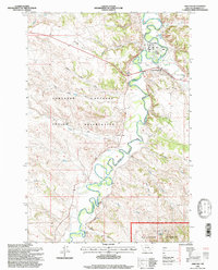
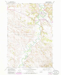
Loading map...1995 Map of Ashland
USGS Topo · Published 1998About this map
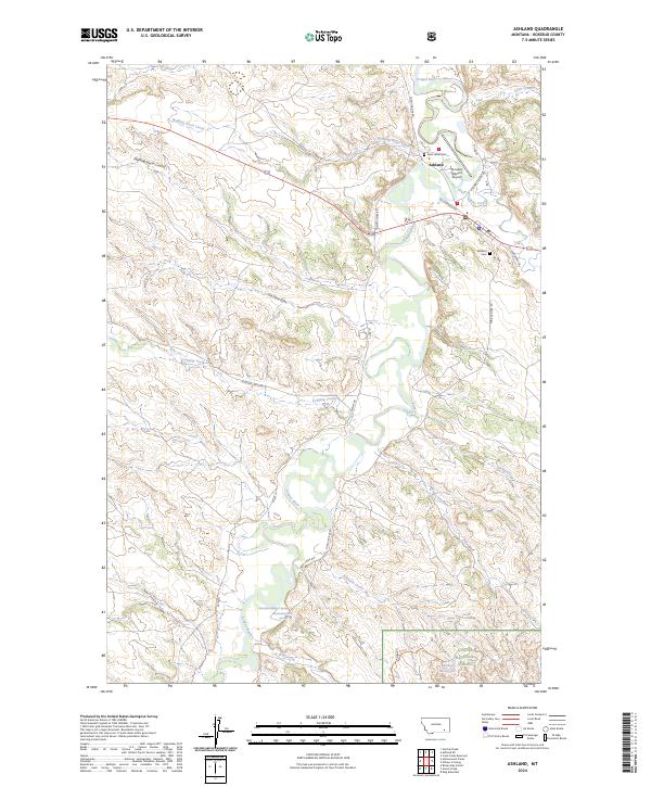
The Tongue River meanders through this portion of Rosebud County, Montana, defining the eastern border of the Northern Cheyenne Indian Reservation. The community of Ashland serves as a central hub, situated near the confluence where Otter Creek meets the main river valley. This 1995 survey illustrates the enduring significance of the St Labre Mission, which stands north of the main settlement with its associated Landing Area.
Find a feature on this map
31 named features on this map. Tap any name to fly to it.
Don’t see what you’re looking for? This feature index may not catch every label — zoom into the map to look around manually.
Map Details
Date Portrayed1995
Date Published1998
PublisherU.S. Geological Survey
Map TypeTopographic
Scale1:24,000
Physical Dimensions21.7 x 26.9 inches
Editions of this 1995 Ashland Map
This is the sole edition of this map. No revisions or reprints were ever made.
Historical Maps of Ashland District Through Time
7 maps found
Featured Locations
Source Details
SourceU.S. Geological Survey
CopyrightPublic Domain