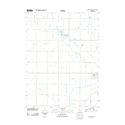
2011 Map of Ashland West
USGS Topo · Published 2011About this map
Memphis sits at the heart of this Saunders County landscape, positioned along the banks of Wahoo Creek and adjacent to Memphis Lake. This area of eastern Nebraska is defined by a dense network of drainage systems, including Silver Creek, Salt Creek, and Mosquito Creek, which converge and wind through a strictly organized grid of rural roads. The infrastructure of the early 21st century is evident in the presence of localized air strips such as Luetkenhaus Airport and Starns Brothers Airport, as well as the Memphis Dam and Memphis Post Office. Toward the southeast corner, the outskirts of Ashland appear, where Salt Creek and Callahan Creek meet. This survey provides a clear view of the transition between small village centers and the broad agricultural parcels that dominate the region, anchored by landmarks like Carr Cemetery and a series of county routes that have historically connected these farming communities.
Find a feature on this map
45 named features on this map. Tap any name to fly to it.
Don’t see what you’re looking for? This feature index may not catch every label — zoom into the map to look around manually.
Map Details
Editions of this 2011 Ashland West Map
This is the sole edition of this map. No revisions or reprints were ever made.
Other maps of this area

1893 · Fremont
USGS Topo · 1:125,000

1896 · Fremont
USGS Topo · 1:125,000

1897 · Lincoln
USGS Topo · 1:125,000

1899 · Wahoo
USGS Topo · 1:125,000

1903 · Weeping Water
USGS Topo · 1:125,000

1929 · Weeping Water
USGS Topo · 1:125,000

1955 · Fremont
USGS Topo · 1:250,000

1955 · Lincoln
USGS Topo · 1:250,000

1957 · Fremont
USGS Topo · 1:250,000

1957 · Lincoln
USGS Topo · 1:250,000