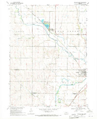
1969 Map of Ashland West
USGS Topo · Published 1971About this map
Memphis and the northern outskirts of Ashland serve as the primary focal points of this 1960s study, where the plains of Saunders County meet the winding course of Wahoo Creek. The landscape is defined by its water and transport networks, notably the Burlington Northern railroad lines that parallel the creek and Silver Creek as they move toward their confluence with Salt Creek. Local recreation and community life are anchored by the Memphis Lake State Recreation Area and the Ashland Country Club, reflecting the area's mix of agriculture and leisure. The map preserves the locations of rural infrastructure such as School No 3 and School No 5, alongside family burial grounds like Carr Cem. These features illustrate the mid-century settlement patterns just before modern expansion began to alter the rural character of this tri-county border region where Saunders, Lancaster, and Cass counties meet.
Find a feature on this map
20 named features on this map. Tap any name to fly to it.
Don’t see what you’re looking for? This feature index may not catch every label — zoom into the map to look around manually.
Map Details
Editions of this 1969 Ashland West Map
This is the sole edition of this map. No revisions or reprints were ever made.
Other maps of this area

1893 · Fremont
USGS Topo · 1:125,000

1896 · Fremont
USGS Topo · 1:125,000

1897 · Lincoln
USGS Topo · 1:125,000

1899 · Wahoo
USGS Topo · 1:125,000

1903 · Weeping Water
USGS Topo · 1:125,000

1929 · Weeping Water
USGS Topo · 1:125,000

1955 · Fremont
USGS Topo · 1:250,000

1955 · Lincoln
USGS Topo · 1:250,000

1957 · Fremont
USGS Topo · 1:250,000

1957 · Lincoln
USGS Topo · 1:250,000