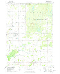
1974 Map of Ashley
USGS Topo · Published 1978About this map
Ashley and Bannister anchor this mid-1970s landscape, illustrating a classic Gratiot County agrarian and transit pattern. The village of Ashley serves as a focal point for rail operations, where the Conrail line intersects with the G T W tracks near the Sewage Disp Ponds. To the north, the terrain transitions into the heavily managed wetlands and woods of the Gratiot-Saginaw State Game Management Area, a significant environmental feature drained by Potato Creek.
Find a feature on this map
36 named features on this map. Tap any name to fly to it.
Don’t see what you’re looking for? This feature index may not catch every label — zoom into the map to look around manually.
Map Details
Editions of this 1974 Ashley Map
This is the sole edition of this map. No revisions or reprints were ever made.
Other maps of this area

1918 · Elsie
USGS Topo · 1:62,500

1918 · Perrinton
USGS Topo · 1:62,500

1934 · Merrill
USGS Topo · 1:62,500

1935 · Alma
USGS Topo · 1:62,500

1937 · Merrill
USGS Topo · 1:62,500

1938 · Alma
USGS Topo · 1:62,500

1943 · Perrinton
USGS Topo · 1:62,500

1943 · Elsie
USGS Topo · 1:62,500

1954 · Midland
USGS Topo · 1:250,000

1958 · Midland
USGS Topo · 1:250,000