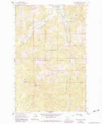
1962 Map of Ashley Mountain
USGS Topo · Published 1983About this map
Ashley Divide and the high peaks of the Flathead National Forest dominate this 1960s topographic survey, capturing a landscape defined by forest management and resource extraction. At the center of the terrain stands Ashley Mountain, crowned by a Lookout Tower that served as a critical vantage point for fire detection. Below the ridges, the map documents the transition from high-altitude wilderness to early ranching and mining activities.
Find a feature on this map
24 named features on this map. Tap any name to fly to it.
Don’t see what you’re looking for? This feature index may not catch every label — zoom into the map to look around manually.
Map Details
Editions of this 1962 Ashley Mountain Map
2 editions found
Other maps of this area

1957 · Kalispell
USGS Topo · 1:250,000

1960 · Kalispell
USGS Topo · 1:250,000

1961 · Kalispell
USGS Topo · 1:250,000

1962 · Johnson Peak
USGS Topo · 1:24,000

1962 · Lost Creek Divide
USGS Topo · 1:24,000

1962 · Ashley Mountain
USGS Topo · 1:24,000
1962 · Tally Lake
USGS Topo · 1:24,000

1963 · Sylvia Lake
USGS Topo · 1:24,000
1963 · Dunsire Point
USGS Topo · 1:24,000
1964 · Lone Lake
USGS Topo · 1:24,000