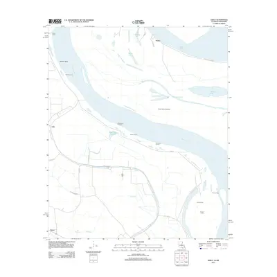
2012 Map of Ashly
USGS Topo · Published 2012About this map
Mississippi River landings and backwater bayous dominate this landscape along the Louisiana and Mississippi border. The geography is defined by a dense network of river-access points, including Ashley Landing, Cabin Teele Landing, and Duckport Landing, reflecting a long-standing reliance on the waterway for transport and commerce. The presence of Millikens Bend and the Cabin Teele Crevasse indicates a history of river engineering and the persistent power of the water over the alluvial plain.
Find a feature on this map
32 named features on this map. Tap any name to fly to it.
Don’t see what you’re looking for? This feature index may not catch every label — zoom into the map to look around manually.
Map Details
Editions of this 2012 Ashly Map
This is the sole edition of this map. No revisions or reprints were ever made.
Other maps of this area

1909 · Millikens Bend
USGS Topo · 1:24,000

1909 · Tallulah
USGS Topo · 1:24,000

1909 · Mound
USGS Topo · 1:24,000

1910 · Mound
USGS Topo · 1:31,680

1918 · Vicksburg
USGS Topo · 1:62,500

1939 · Onward
USGS Topo · 1:62,500

1939 · Talla Bena
USGS Topo · 1:62,500

1939 · Alsatia
USGS Topo · 1:62,500

1941 · Vicksburg
USGS Topo · 1:62,500

1955 · Jackson
USGS Topo · 1:250,000