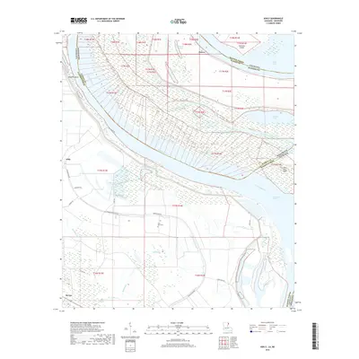
2018 Map of Ashly
USGS Topo · Published 2018About this map
The Mississippi River defines the complex hydrography of this Louisiana-Mississippi borderland, where the river's shifting path has left behind a landscape of oxbows, chutes, and cutoffs. Modern surveys show the alluvial bottomlands of Madison Parish and Warren Co, a region marked by historic fluvial features like Millikens Bend and Australia Island. The land is networked with drainage and irrigation systems, including the Macon Slough and Mill Bayou, which support the agricultural tracts between Ashly and Barnes.
Find a feature on this map
42 named features on this map. Tap any name to fly to it.
Don’t see what you’re looking for? This feature index may not catch every label — zoom into the map to look around manually.
Map Details
Editions of this 2018 Ashly Map
This is the sole edition of this map. No revisions or reprints were ever made.
Other maps of this area

1909 · Millikens Bend
USGS Topo · 1:24,000

1909 · Tallulah
USGS Topo · 1:24,000

1909 · Mound
USGS Topo · 1:24,000

1910 · Mound
USGS Topo · 1:31,680

1918 · Vicksburg
USGS Topo · 1:62,500

1939 · Onward
USGS Topo · 1:62,500

1939 · Talla Bena
USGS Topo · 1:62,500

1939 · Alsatia
USGS Topo · 1:62,500

1941 · Vicksburg
USGS Topo · 1:62,500

1955 · Jackson
USGS Topo · 1:250,000