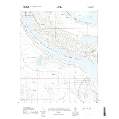
2020 Map of Ashly
USGS Topo · Published 2020About this map
Mississippi River shifts and historical bank lines dominate this part of Madison Parish, Louisiana, where the water forms a complex border with Mississippi. The landscape is defined by its fluvial history, evidenced by the large oxbow of Eagle Lake and secondary water bodies like Grassy Lake and Pervis Lake. The settlement of Ashly sits near the river's edge, surrounded by a network of local roads such as Thomastown Rd and Duckport Rd.
Find a feature on this map
40 named features on this map. Tap any name to fly to it.
Don’t see what you’re looking for? This feature index may not catch every label — zoom into the map to look around manually.
Map Details
Editions of this 2020 Ashly Map
This is the sole edition of this map. No revisions or reprints were ever made.
Other maps of this area

1909 · Millikens Bend
USGS Topo · 1:24,000

1909 · Tallulah
USGS Topo · 1:24,000

1909 · Mound
USGS Topo · 1:24,000

1910 · Mound
USGS Topo · 1:31,680

1918 · Vicksburg
USGS Topo · 1:62,500

1939 · Onward
USGS Topo · 1:62,500

1939 · Talla Bena
USGS Topo · 1:62,500

1939 · Alsatia
USGS Topo · 1:62,500

1941 · Vicksburg
USGS Topo · 1:62,500

1955 · Jackson
USGS Topo · 1:250,000