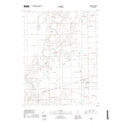
2018 Map of Ashmore
USGS Topo · Published 2018About this map
Ashmore anchors this 2018 survey of eastern Coles County, where the transition from flat Midwestern prairie to the wooded bluffs of the Embarras River creates a varied rural landscape. This region is characterized by a dense network of family and community burial grounds, including Saint Omer Cem, Zimmerman Cem, and the Patsy Mitchell Cem, which reflect the generations of farming families that settled these townships. The Embarras River and its tributary, the Little Embarras River, cut deep paths through the terrain, bridged by landmarks such as the Airtight Bridge. Small rail-side or crossroads settlements like Rardin and Embarrass appear alongside modern aviation infrastructure at the John R Reed Airport. The map documents the enduring agricultural grid, interspersed with wooded creeks like Polecat Cr and Brush Cr, preserving the spatial relationship between historic churchyards and the surrounding farmland.
Find a feature on this map
99 named features on this map. Tap any name to fly to it.
Don’t see what you’re looking for? This feature index may not catch every label — zoom into the map to look around manually.
Map Details
Editions of this 2018 Ashmore Map
This is the sole edition of this map. No revisions or reprints were ever made.
Other maps of this area

1933 · Toledo
USGS Topo · 1:62,500

1936 · Oakland
USGS Topo · 1:48,000

1936 · Casey
USGS Topo · 1:48,000

1938 · Toledo
USGS Topo · 1:62,500

1942 · Oakland
USGS Topo · 1:62,500

1942 · Casey
USGS Topo · 1:62,500

1943 · Casey
USGS Topo · 1:62,500

1946 · Kansas
USGS Topo · 1:62,500

1949 · Kansas
USGS Topo · 1:62,500

1953 · Indianapolis
USGS Topo · 1:250,000