
1949 Map of Kansas
USGS Topo · Published 1949About this map
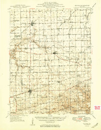
The Embarrass River and its various forks carve through this section of eastern Illinois, shaping a landscape defined by organized agricultural townships and a dense network of local institutions. Surveyed in the late 1940s, the map reveals the importance of rural schools and churches to the community, with dozens of named sites like Golden Rule Sch, Pilot Grove Sch, and Prairie Chapel peppered across the grid. The regional economy is anchored by the crossing of the Pennsylvania and New York Central railroads, which facilitated the growth of shipping points such as Kansas and Brocton. In the southern portion of the quadrangle, the terrain becomes more varied around Dole Hill and Blue Mound, where family cemeteries like the Gines Cem and Rudy Cem provide vital links for those tracing local lineages.
Find a feature on this map
103 named features on this map. Tap any name to fly to it.
Don’t see what you’re looking for? This feature index may not catch every label — zoom into the map to look around manually.
Map Details
Editions of this 1949 Kansas Map
2 editions found
Other maps of this area

1932 · Marshall
USGS Topo · 1:62,500

1933 · Toledo
USGS Topo · 1:62,500

1936 · Oakland
USGS Topo · 1:48,000

1936 · Casey
USGS Topo · 1:48,000

1937 · Marshall
USGS Topo · 1:62,500

1938 · Toledo
USGS Topo · 1:62,500

1942 · Oakland
USGS Topo · 1:62,500

1942 · Casey
USGS Topo · 1:62,500

1943 · Casey
USGS Topo · 1:62,500

1946 · Kansas
USGS Topo · 1:62,500