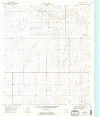
1969 Map of Ashmore
USGS Topo · Published 1971About this map
Adair Oil Field dominates this West Texas landscape along the Terry Co Gaines Co line, revealing an intensive network of petroleum extraction at the end of the 1960s. The terrain is characterized by the broad, dry channel of Sulphur Springs Draw winding through the northern portion of the quadrangle. Industrial infrastructure is concentrated around the small settlements of Ashmore and Adair, where a localized Refinery and a vast field of Oil Wells illustrate the region's mid-century economic driver.
Find a feature on this map
9 named features on this map. Tap any name to fly to it.
Don’t see what you’re looking for? This feature index may not catch every label — zoom into the map to look around manually.
Map Details
Editions of this 1969 Ashmore Map
2 editions found
Other maps of this area

1954 · Hobbs
USGS Topo · 1:250,000

1954 · Brownfield
USGS Topo · 1:250,000

1958 · Brownfield
USGS Topo · 1:250,000

1958 · Hobbs
USGS Topo · 1:250,000

1962 · Brownfield
USGS Topo · 1:250,000

1969 · Foster
USGS Topo · 1:24,000

1969 · Loop
USGS Topo · 1:24,000

1969 · Ashmore
USGS Topo · 1:24,000

1969 · Welch SW
USGS Topo · 1:24,000
1969 · Union School
USGS Topo · 1:24,000