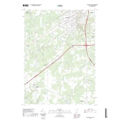
2023 Map of Ashtabula South
USGS Topo · Published 2023About this map
The city of Ashtabula anchors the northern edge of this landscape, where the Ashtabula River flows toward Lake Erie. This 2023 survey illustrates the dense residential grid of Saybrook-on-the-Lake and Edgewood transitioning southward into the agricultural and wooded expanses of the Ohio lake plain. A notable density of local history is preserved in the area's numerous burial grounds, such as Chestnut Grove Cem and the Ridgeview Burial Park, which are interspersed among rolling terrain marked by prominent landmarks like Munson Hill.
Find a feature on this map
127 named features on this map. Tap any name to fly to it.
Don’t see what you’re looking for? This feature index may not catch every label — zoom into the map to look around manually.
Map Details
Editions of this 2023 Ashtabula South Map
This is the sole edition of this map. No revisions or reprints were ever made.
Other maps of this area

1905 · Andover
USGS Topo · 1:48,000

1905 · Ashtabula
USGS Topo · 1:62,500

1905 · Jefferson
USGS Topo · 1:62,500

1906 · Conneaut
USGS Topo · 1:62,500

1907 · Andover
USGS Topo · 1:62,500

1907 · Jefferson
USGS Topo · 1:62,500

1950 · Cleveland
USGS Topo · 1:250,000

1956 · Cleveland
USGS Topo · 1:250,000

1959 · Dorset
USGS Topo · 1:24,000

1959 · East Trumbull
USGS Topo · 1:24,000