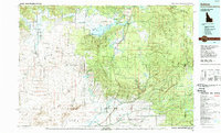
1989 Map of Ashton
USGS Topo · Published 1989About this map
The confluence of the Henrys Fork and Fall River defines the landscape surrounding Ashton, Idaho, during this late-twentieth-century period. This map captures a transition from the agricultural lowlands near Marysville and Grainville to the high timber of the Targhee National Forest and the southwestern edge of Yellowstone National Park. The Union Pacific rail line and U.S. 20 serve as primary transportation corridors, connecting the dispersed settlements of Kilgore, Drummond, and Macks Inn with the vast recreational and wildlife lands of the Harriman State Park and the Sand Creek Wildlife Management Area. Geologic history is visible through features like Split Rock, Butte Crater, and the extensive Sand Dunes to the southwest. The presence of the Island Park Reservoir and numerous creeks such as Squirrel Creek and Conant Creek highlights the region's importance for irrigation and outdoor recreation.
Find a feature on this map
75 named features on this map. Tap any name to fly to it.
Don’t see what you’re looking for? This feature index may not catch every label — zoom into the map to look around manually.
Map Details
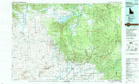
Editions of this 1989 Ashton Map
2 editions found
Other maps of this area

1885 · Gallatin
USGS Topo · 1:125,000

1885 · Gallatin
USGS Topo · 1:125,000

1886 · Shoshone
USGS Topo · 1:125,000

1888 · Shoshone
USGS Topo · 1:125,000

1895 · Shoshone
USGS Topo · 1:125,000

1899 · Grand Teton
USGS Topo · 1:125,000

1901 · Shoshone
USGS Topo · 1:125,000

1901 · Gallatin
USGS Topo · 1:125,000

1901 · Grand Teton
USGS Topo · 1:125,000

1908 · Gallatin
USGS Topo · 1:125,000