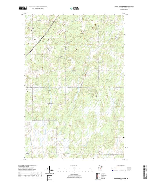
2022 Map of Askov Lookout Tower
USGS Topo · Published 2022About this map
Vilstad Lutheran Cem and Danforth Cem anchor the northern and southern corners of this Pine County landscape, highlighting the generations of family history tied to the area's rural townships. The terrain is defined by a dense network of winding watercourses, including the north-flowing Partridge Cr and the southerly Sand Cr, Wolf Cr, and Hay Cr. This drainage pattern influenced the development of the local road system, where family-named routes like Blackberry Rd, Rutabaga Rd, and Sunrise Rd weave between marshlands and forested sections. The grid is further articulated by major local arteries such as Duxbury Rd and Cloverdale Rd, which connect the scattered rural residences and farmsteads. This survey captures a moment in time where the local infrastructure, from Co Hwy 22 to the winding S Fleming Loop, maintains a quiet, agricultural character in eastern Minnesota.
Find a feature on this map
42 named features on this map. Tap any name to fly to it.
Don’t see what you’re looking for? This feature index may not catch every label — zoom into the map to look around manually.
Map Details
Editions of this 2022 Askov Lookout Tower Map
This is the sole edition of this map. No revisions or reprints were ever made.
Other maps of this area

1953 · Duluth
USGS Topo · 1:250,000

1958 · Duluth
USGS Topo · 1:250,000

1961 · Sandstone
USGS Topo · 1:62,500

1961 · Moose Lake
USGS Topo · 1:62,500

1962 · Bruno
USGS Topo · 1:62,500

1962 · Cloverdale
USGS Topo · 1:62,500

1980 · Sandstone
USGS Topo · 1:100,000
1981 · Cloverdale
USGS Topo · 1:24,000
1981 · Askov Lookout Tower
USGS Topo · 1:24,000
1981 · Kerrick
USGS Topo · 1:24,000
Featured Places
- Fleming Township, MN
- Sandstone Township, MN
- Norman Township, MN
- Partridge Township, MN
- Danforth Township, MN