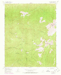
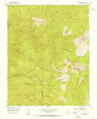
1953 Map of Aspen Basin
USGS Topo · Published 1978About this map
High peaks of the Sangre de Cristo Mountains dominate this survey, which captures the development of high-altitude recreation and land grants east of Santa Fe. The landscape is defined by its drainage systems, including the Rio Nambe and the headwaters of the Santa Fe River, which flow from alpine basins near Santa Fe Baldy. Cultural footprints are found at Rancho Viejo and Aspen Ranch, while the mid-century emergence of winter sports is marked by the Aspen Basin Ski Lift and Sierra Lodge within the Santa Fe Recreation Area. Large tracts of land remain tied to historical boundaries, such as the Juan de Gabaldon Grant and the Nambe Indian Reservation Forest Boundary. Numerous pack trails, including the Windsor Trail and Borrego Trail, crisscross the ridges, providing access to remote high-country points like Penitente Peak and Katherine Lake.
Find a feature on this map
36 named features on this map. Tap any name to fly to it.
Don’t see what you’re looking for? This feature index may not catch every label — zoom into the map to look around manually.
Map Details
Editions of this 1953 Aspen Basin Map
6 editions found
Other maps of this area

1889 · Santa Fe
USGS Topo · 1:125,000

1894 · Santa Fe
USGS Topo · 1:125,000

1952 · Santa Fe
USGS Topo · 1:24,000

1953 · Tesuque
USGS Topo · 1:24,000

1953 · Sierra Mosca
USGS Topo · 1:24,000
1953 · Cundiyo
USGS Topo · 1:24,000

1953 · Mc Clure Reservoir
USGS Topo · 1:24,000

1953 · Aspen Basin
USGS Topo · 1:24,000

1954 · Santa Fe
USGS Topo · 1:250,000

1958 · Santa Fe
USGS Topo · 1:250,000