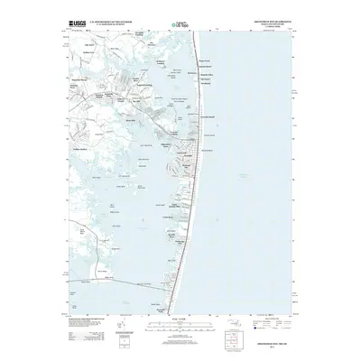
2013 Map of Assawoman Bay
USGS Topo · Published 2013About this map
The coastal boundary between Maryland and Delaware defines this 2013 topographic survey, where Fenwick Island serves as a narrow barrier between the Atlantic Ocean and the sprawling waters of Assawoman Bay. This landscape is a complex network of residential developments and maritime features, ranging from the established Fenwick Island Lighthouse to modern communities like Montego Bay, Swann Keys, and Caine Keys. The map reveals the intricate transition from mainland to marsh, documented through family-named points and inlets such as Miller Neck, Dirickson Neck, and Johns Hammock. Watercraft access points are prominent, including Sassafras Landing, Mulberry Landing, and the Advanced Marina near the Assawoman Bay Bridge. From the northern reaches of Little Bay down to Isle of Wight Bay, the map provides a precise record of late-twentieth-century coastal engineering, leisure development, and the preserved wetlands of the Delmarva shoreline.
Find a feature on this map
100 named features on this map. Tap any name to fly to it.
Don’t see what you’re looking for? This feature index may not catch every label — zoom into the map to look around manually.
Map Details
Editions of this 2013 Assawoman Bay Map
This is the sole edition of this map. No revisions or reprints were ever made.
Other maps of this area

1901 · Ocean City
USGS Topo · 1:62,500

1918 · Rehoboth
USGS Topo · 1:62,500

1938 · Rehoboth
USGS Topo · 1:62,500

1942 · Ocean City
USGS Topo · 1:62,500

1942 · Ocean City
USGS Topo · 1:24,000

1943 · Selbyville
USGS Topo · 1:31,680
1943 · Berlin
USGS Topo · 1:31,680
1943 · Ocean City
USGS Topo · 1:31,680
1943 · Assawoman Bay
USGS Topo · 1:31,680
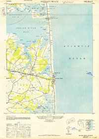
1943 · Bethany Beach
USGS Topo · 1:24,000