Loading...
Loading map...1981 Map of Astoria
USGS Topo · Published 1981About this map
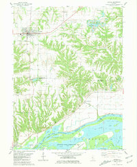
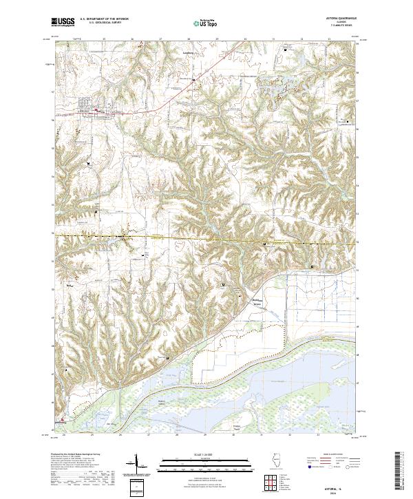
Astoria and the surrounding agricultural uplands are captured in the early 1980s, revealing a landscape defined by the intersection of rural life and industrial legacy. In the northeast, a notable Strip Mined Area near Isaac Walton Park shows the impact of resource extraction on the terrain. This is balanced by the complex hydrology of the south, where the Illinois River and Sanganois State Conservation Area dominate the lowlands.
Find a feature on this map
55 named features on this map. Tap any name to fly to it.
Don’t see what you’re looking for? This feature index may not catch every label — zoom into the map to look around manually.
Map Details
Date Portrayed1981
Date Published1981
PublisherU.S. Geological Survey
Map TypeTopographic
Scale1:24,000
Physical Dimensions22 x 26.8 inches
Editions of this 1981 Astoria Map
This is the sole edition of this map. No revisions or reprints were ever made.
Historical Maps of Astoria Through Time
6 maps found

Featured Locations
Source Details
SourceU.S. Geological Survey
CopyrightPublic Domain