
1963 Map of Athens
USGS Topo · Published 1963About this map
Athens and Augusta anchor this regional perspective of Eastern Georgia and a portion of South Carolina, revealing a landscape defined by expansive river systems and major 1950s-era water management projects. The map highlights the significant footprint of the Fort Gordon Military Reservation and the sprawling Clark Hill Reservoir along the Savannah River. The interconnected network of the Oconee River, Appalachee River, and Ocmulgee River illustrates the natural drainage patterns of the Piedmont, supporting historic county seats like Madison, Covington, and Monticello.
Find a feature on this map
75 named features on this map. Tap any name to fly to it.
Don’t see what you’re looking for? This feature index may not catch every label — zoom into the map to look around manually.
Map Details
Editions of this 1963 Athens Map
This is the sole edition of this map. No revisions or reprints were ever made.
Other maps of this area

1888 · Atlanta
USGS Topo · 1:125,000

1890 · Suwanee
USGS Topo · 1:125,000

1890 · Atlanta
USGS Topo · 1:125,000

1891 · Gainesville
USGS Topo · 1:125,000

1891 · Carnesville
USGS Topo · 1:125,000

1892 · Mc Cormick
USGS Topo · 1:125,000

1892 · Abbeville
USGS Topo · 1:125,000

1892 · Atlanta
USGS Topo · 1:125,000
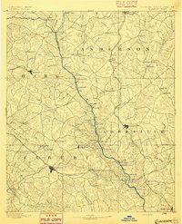
1893 · Elberton
USGS Topo · 1:125,000

1894 · Suwanee
USGS Topo · 1:125,000