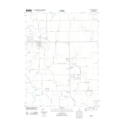
2012 Map of Athens
USGS Topo · Published 2012About this map
Athens serves as the primary hub of this Central Illinois landscape, where the grid of the town meets the winding course of Town Br and the nearby Sangamon River. The area is characterized by a mix of agricultural plots and small residential clusters like Barr, North Wind, and Green Acres. A notable density of local history is preserved in several burial grounds, including West Cem, Joel Hall Cem, and Brittin Cem. The rural infrastructure is further highlighted by aviation markers such as Wilcoxon Airport and the Fisher Landing Strip. Water resources shape the southern reaches of the map, specifically around Cilca Lake and the recreational grounds of Camp Cilca, while Jefferies Orchard points to the continued importance of specialty agriculture in the region.
Find a feature on this map
105 named features on this map. Tap any name to fly to it.
Don’t see what you’re looking for? This feature index may not catch every label — zoom into the map to look around manually.
Map Details
Editions of this 2012 Athens Map
This is the sole edition of this map. No revisions or reprints were ever made.
Other maps of this area

1907 · Springfield
USGS Topo · 1:62,500

1909 · Tallula
USGS Topo · 1:62,500

1930 · Springfield
USGS Topo · 1:62,500

1933 · Petersburg
USGS Topo · 1:62,500

1938 · Petersburg
USGS Topo · 1:62,500

1940 · Tallula
USGS Topo · 1:62,500

1940 · Springfield
USGS Topo · 1:62,500

1948 · Mason City
USGS Topo · 1:62,500

1949 · Mason City
USGS Topo · 1:62,500

1950 · Springfield West
USGS Topo · 1:24,000