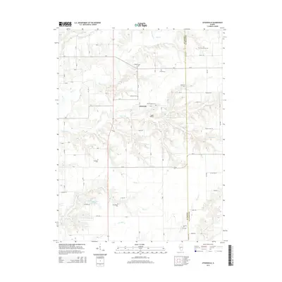
2015 Map of Athensville
USGS Topo · Published 2015About this map
Athensville sits at the heart of this landscape along the eastern edge of Greene County, where the terrain is intricately carved by several waterways. The drainage pattern is defined by the winding paths of Apple Creek and Negro Lick, which flow through a region marked by numerous small branches and deep-set hollows like Happy Hollow. This rural area exhibits a high density of small family and community burial grounds, essential for genealogical research. Prominent sites include the Athensville Cemetery, the Drake-Million Cemetery, and the Reeve-Mayberry Cemetery. To the south, the Woodbine Country Club Lake provides a notable point of interest amidst the agricultural fields and wooded draws. The map illustrates a developed network of county routes and rural roads, such as Possom Trot Road and Athensville Road, that connect the various farms and homesteads scattered across the county line near Macoupin County.
Find a feature on this map
51 named features on this map. Tap any name to fly to it.
Don’t see what you’re looking for? This feature index may not catch every label — zoom into the map to look around manually.
Map Details
Editions of this 2015 Athensville Map
This is the sole edition of this map. No revisions or reprints were ever made.
Other maps of this area

1924 · Winchester
USGS Topo · 1:48,000

1924 · Roodhouse
USGS Topo · 1:62,500

1926 · Winchester
USGS Topo · 1:62,500

1926 · Roodhouse
USGS Topo · 1:62,500

1932 · Greenfield
USGS Topo · 1:62,500

1932 · Jacksonville
USGS Topo · 1:62,500

1937 · Jacksonville
USGS Topo · 1:62,500

1948 · Quincy
USGS Topo · 1:250,000

1956 · Quincy
USGS Topo · 1:250,000
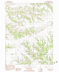
1983 · Manchester
USGS Topo · 1:24,000