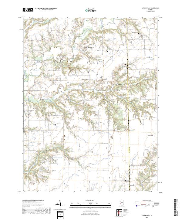
2024 Map of Athensville
USGS Topo · Published 2024About this map
Athensville serves as the central hub of this agricultural landscape in Greene County, where the terrain is deeply dissected by a network of drainage branches and creeks. The intricate topography is defined by the winding course of Apple Creek and its many tributaries, including Little Apple Creek, Negro Lick, and Cole Branch. These waterways have carved out distinct features like Happy Hollow, creating a complex environment of ridges and valleys that dictate the local road network.
Find a feature on this map
63 named features on this map. Tap any name to fly to it.
Don’t see what you’re looking for? This feature index may not catch every label — zoom into the map to look around manually.
Map Details
Editions of this 2024 Athensville Map
This is the sole edition of this map. No revisions or reprints were ever made.
Other maps of this area

1924 · Winchester
USGS Topo · 1:48,000

1924 · Roodhouse
USGS Topo · 1:62,500

1926 · Winchester
USGS Topo · 1:62,500

1926 · Roodhouse
USGS Topo · 1:62,500

1932 · Greenfield
USGS Topo · 1:62,500

1932 · Jacksonville
USGS Topo · 1:62,500

1937 · Jacksonville
USGS Topo · 1:62,500

1948 · Quincy
USGS Topo · 1:250,000

1956 · Quincy
USGS Topo · 1:250,000
1983 · Manchester
USGS Topo · 1:24,000