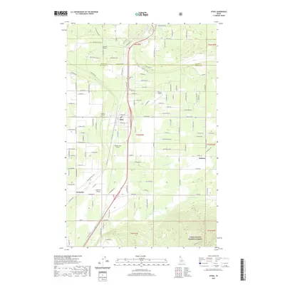
2020 Map of Athol
USGS Topo · Published 2020About this map
The Purcell Trench corridor defines this portion of Kootenai County, where the settlement of Athol sits at a critical junction of northern Idaho travel. This survey highlights the region's transition from the open flats of Eightmile Prairie to the rising timber of the Coeur D'Alene National Forest in the southeast. The landscape is marked by a blend of rural residential growth and aviation, evidenced by the presence of both Hackney Airpark and the Western Spur Airport.
Find a feature on this map
125 named features on this map. Tap any name to fly to it.
Don’t see what you’re looking for? This feature index may not catch every label — zoom into the map to look around manually.
Map Details
Editions of this 2020 Athol Map
This is the sole edition of this map. No revisions or reprints were ever made.
Other maps of this area

1901 · Sandpoint
USGS Topo · 1:125,000

1903 · Rathdrum
USGS Topo · 1:125,000

1911 · Priest Lake
USGS Topo · 1:250,000

1911 · Sandpoint
USGS Topo · 1:125,000

1913 · Priest Lake
USGS Topo · 1:250,000

1955 · Spokane
USGS Topo · 1:250,000

1958 · Spokane
USGS Topo · 1:250,000

1958 · Sandpoint
USGS Topo · 1:250,000

1961 · Hayden
USGS Topo · 1:24,000

1961 · Bayview
USGS Topo · 1:24,000