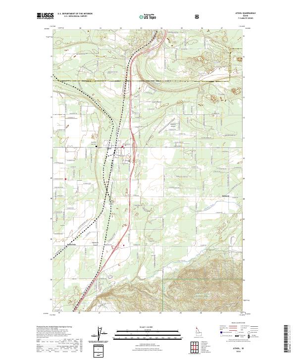
2024 Map of Athol
USGS Topo · Published 2024About this map
Athol stands as the primary hub in this Kootenai County landscape, where the flat expanse of Eightmile Prairie meets the rising timber of the Coeur D'Alene National Forest. This modern survey reveals a community shaped by aviation and north-south transit, with both Western Spur Airport and Hackney Airpark situated along the US Hwy 95 corridor. The geography transitions from the residential street grids near North Pole to the steep, wooded slopes of Cedar Mtn in the southeast. Historical markers of early settlement remain visible, including the Mountain View Cem and the community of Belmont located near Lewellen Creek. The map documents a complex network of forest development roads and rural residential lanes, such as E Bunco Rd and Smylie Blvd, which provide access to the outlying springs and creek drainages that define the local watershed.
Find a feature on this map
126 named features on this map. Tap any name to fly to it.
Don’t see what you’re looking for? This feature index may not catch every label — zoom into the map to look around manually.
Map Details
Editions of this 2024 Athol Map
This is the sole edition of this map. No revisions or reprints were ever made.
Other maps of this area

1901 · Sandpoint
USGS Topo · 1:125,000

1903 · Rathdrum
USGS Topo · 1:125,000

1911 · Priest Lake
USGS Topo · 1:250,000

1911 · Sandpoint
USGS Topo · 1:125,000

1913 · Priest Lake
USGS Topo · 1:250,000

1955 · Spokane
USGS Topo · 1:250,000

1958 · Spokane
USGS Topo · 1:250,000

1958 · Sandpoint
USGS Topo · 1:250,000

1961 · Hayden
USGS Topo · 1:24,000

1961 · Bayview
USGS Topo · 1:24,000