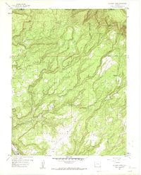
1960 Map of Atkinson Creek
USGS Topo · Published 1961About this map
The Uncompahgre National Forest dominates this landscape on the boundary of Mesa and Montrose Counties, where the dramatic topography of the Atkinson Breaks meets the San Miguel River valley. This 1960 revision documents the area's mid-century character, notably marked by Airstrips positioned on Spring Creek Mesa, reflecting the era's reliance on small aircraft for accessing these high mesa tops. The map details a rugged drainage system including Big Atkinson Creek and Bull Draw, which carve through the high plateaus of Little Atkinson Mesa and East Mesa. While largely a wilderness of canyons and bluffs, the presence of Spring Creek Ranch and the edge of Uravan show the scattered human footprint amidst natural features like Gypsum Bluff and Blue Springs.
Find a feature on this map
29 named features on this map. Tap any name to fly to it.
Don’t see what you’re looking for? This feature index may not catch every label — zoom into the map to look around manually.
Map Details
Editions of this 1960 Atkinson Creek Map
3 editions found
Other maps of this area

1916 · Paradox Valley
USGS Topo · 1:125,000

1922 · Paradox Valley
USGS Topo · 1:125,000

1948 · Uravan
USGS Topo · 1:24,000

1949 · Davis Mesa
USGS Topo · 1:24,000

1949 · Uravan
USGS Topo · 1:24,000

1949 · Atkinson Creek
USGS Topo · 1:24,000

1949 · Red Canyon
USGS Topo · 1:24,000

1949 · Calamity Mesa
USGS Topo · 1:24,000

1950 · Calamity Mesa
USGS Topo · 1:24,000

1950 · Atkinson Creek
USGS Topo · 1:24,000