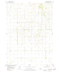
1954 Map of Atkinson NW
USGS Topo · Published 1977About this map
Sand Creek and the Saratoga township area define this mid-century landscape in Holt County, where the plains are marked by a sparse but vital network of rural infrastructure. The map reveals the distribution of early education and community life through sites like Sunnyside Sch, Celia Sch, and School No 89. These small schools, often spaced just a few miles apart, reflect the era's settlement density before the consolidation of rural districts. Along the intermittent drainage of Brush Creek, the map labels numerous Windmill sites, indicating the essential role of groundwater for agriculture and livestock in this high-plains environment. Near the center of the sheet, the Celia Cem stands as a quiet marker of the local families who established these ranching and farming communities in the northern Atkinson region.
Find a feature on this map
9 named features on this map. Tap any name to fly to it.
Don’t see what you’re looking for? This feature index may not catch every label — zoom into the map to look around manually.
Map Details
Editions of this 1954 Atkinson NW Map
2 editions found
Other maps of this area

1951 · Butte SW
USGS Topo · 1:24,000

1951 · Dustin
USGS Topo · 1:24,000

1952 · Butte SE
USGS Topo · 1:24,000

1954 · Atkinson SE
USGS Topo · 1:24,000

1954 · Atkinson
USGS Topo · 1:24,000

1954 · Stuart SE
USGS Topo · 1:24,000

1954 · Atkinson NW
USGS Topo · 1:24,000

1954 · Atkinson NE
USGS Topo · 1:24,000

1954 · Stuart NE
USGS Topo · 1:24,000

1955 · O'Neill
USGS Topo · 1:250,000