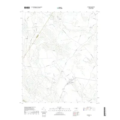
2019 Map of Atkinson
USGS Topo · Published 2019About this map
Atkinson sits as a central hub in this Pender County landscape, where the town layout is defined by streets like W Main St and W Church St. The map reveals a region deeply tied to its hydrological network, with the Black River forming a natural boundary to the west and the massive expanse of Hawes Marsh dominating the southern terrain. This 2019 survey documents a rural environment where land use is split between these wetlands and higher-ground settlements like Ivanhoe and Reb Kee.
Find a feature on this map
66 named features on this map. Tap any name to fly to it.
Don’t see what you’re looking for? This feature index may not catch every label — zoom into the map to look around manually.
Map Details
Editions of this 2019 Atkinson Map
This is the sole edition of this map. No revisions or reprints were ever made.
Other maps of this area

1953 · Florence
USGS Topo · 1:250,000

1954 · Florence
USGS Topo · 1:250,000

1954 · White Lake
USGS Topo · 1:62,500

1954 · Acme
USGS Topo · 1:62,500

1954 · Bolton
USGS Topo · 1:62,500

1955 · Atkinson
USGS Topo · 1:62,500
1980 · Point Caswell
USGS Topo · 1:24,000
1980 · Currie
USGS Topo · 1:24,000

1982 · Elizabethtown
USGS Topo · 1:100,000
1983 · Point Caswell
USGS Topo · 1:24,000