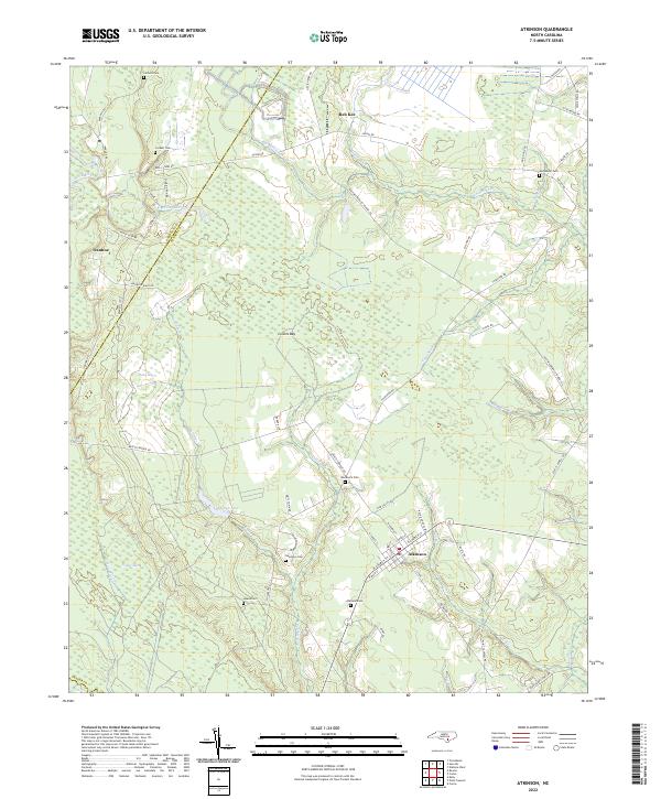
2022 Map of Atkinson
USGS Topo · Published 2022About this map
The Black River forms a natural border along the western edge of this Pender County landscape, where the Sampson Co Pender Co line meets the riverbank near Ivanhoe. The terrain is defined by a complex network of wetland features, including the broad Colvins Bay and Hawes Marsh, which illustrate the low-lying coastal plain environment. Numerous small watercourses like Tuckahoe Br and Colvins Cr drain toward the river, framing the agricultural and residential pockets of the area.
Find a feature on this map
66 named features on this map. Tap any name to fly to it.
Don’t see what you’re looking for? This feature index may not catch every label — zoom into the map to look around manually.
Map Details
Editions of this 2022 Atkinson Map
This is the sole edition of this map. No revisions or reprints were ever made.
Other maps of this area

1953 · Florence
USGS Topo · 1:250,000

1954 · Florence
USGS Topo · 1:250,000

1954 · White Lake
USGS Topo · 1:62,500

1954 · Acme
USGS Topo · 1:62,500

1954 · Bolton
USGS Topo · 1:62,500

1955 · Atkinson
USGS Topo · 1:62,500
1980 · Point Caswell
USGS Topo · 1:24,000
1980 · Currie
USGS Topo · 1:24,000

1982 · Elizabethtown
USGS Topo · 1:100,000
1983 · Point Caswell
USGS Topo · 1:24,000