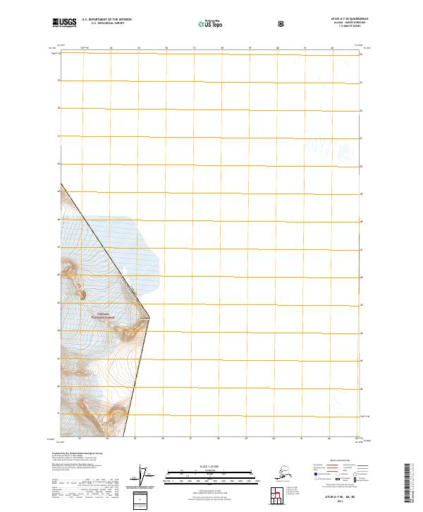
2021 Map of Atlin A-7 SE
USGS Topo · Published 2021About this map
The international boundary between Canada and the United States cuts through this high-altitude landscape within the Tongass National Forest. Dominated by ice and elevation, the terrain features the sprawling Field Glacier and the peak of Mt London. This 2021 survey illustrates the precise coordinates of the border as it traverses the ice fields, marked by survey identifiers t32s r65e and t33s r66e. The map serves as a record of the modern glacial extent in this remote corner of the Haines Borough, where the physical geography of the Coast Mountains dictates the political limits of two nations.
Find a feature on this map
6 named features on this map. Tap any name to fly to it.
Don’t see what you’re looking for? This feature index may not catch every label — zoom into the map to look around manually.
Map Details
Editions of this 2021 Atlin A-7 SE Map
This is the sole edition of this map. No revisions or reprints were ever made.
Other maps of this area

1949 · Atlin
USGS Topo · 1:250,000

1951 · Juneau
USGS Topo · 1:250,000

1951 · Atlin
USGS Topo · 1:250,000

1960 · Juneau D-1
USGS Topo · 1:63,360

1960 · Juneau D-2
USGS Topo · 1:63,360
1960 · Atlin A-7
USGS Topo · 1:63,360

1960 · Atlin
USGS Topo · 1:250,000

1962 · Juneau
USGS Topo · 1:250,000
1997 · Juneau D-2
USGS Topo · 1:63,360
2004 · Atlin A-7
USGS Topo · 1:63,360