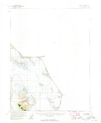
1960 Map of Atlin A-7
USGS Topo · Published 1965About this map
Mt Poletica stands as a primary high point along the international divide in this 1960 survey of the Alaskan wilderness near the Canadian border. The landscape is defined by its extreme glacial features and high-altitude surveying markers, including Boundary Peak 103, Boundary Peak 101, and Boundary Peak 102. This map, based on 1948 aerial photography and 1960 field annotation, serves as a record of the trans-border region where the United States Canada line follows a series of jagged summits. The presence of numerous Crevasses across the ice fields emphasizes the volatile nature of the terrain, while the sparse nomenclature reflects an area almost entirely devoid of permanent human settlement or infrastructure during the mid-20th century. Local boundaries for T. 32 S. and R. 65 E. are projected across the ice, though the margin notes these locations remained unsurveyed and unmarked at the time.
Find a feature on this map
14 named features on this map. Tap any name to fly to it.
Don’t see what you’re looking for? This feature index may not catch every label — zoom into the map to look around manually.
Map Details
Editions of this 1960 Atlin A-7 Map
2 editions found
Other maps of this area

1949 · Atlin
USGS Topo · 1:250,000

1951 · Juneau
USGS Topo · 1:250,000

1951 · Atlin
USGS Topo · 1:250,000

1960 · Juneau D-1
USGS Topo · 1:63,360

1960 · Juneau D-2
USGS Topo · 1:63,360

1960 · Atlin A-8
USGS Topo · 1:63,360
1960 · Atlin B-8
USGS Topo · 1:63,360

1960 · Atlin
USGS Topo · 1:250,000

1962 · Juneau
USGS Topo · 1:250,000
1997 · Juneau D-2
USGS Topo · 1:63,360