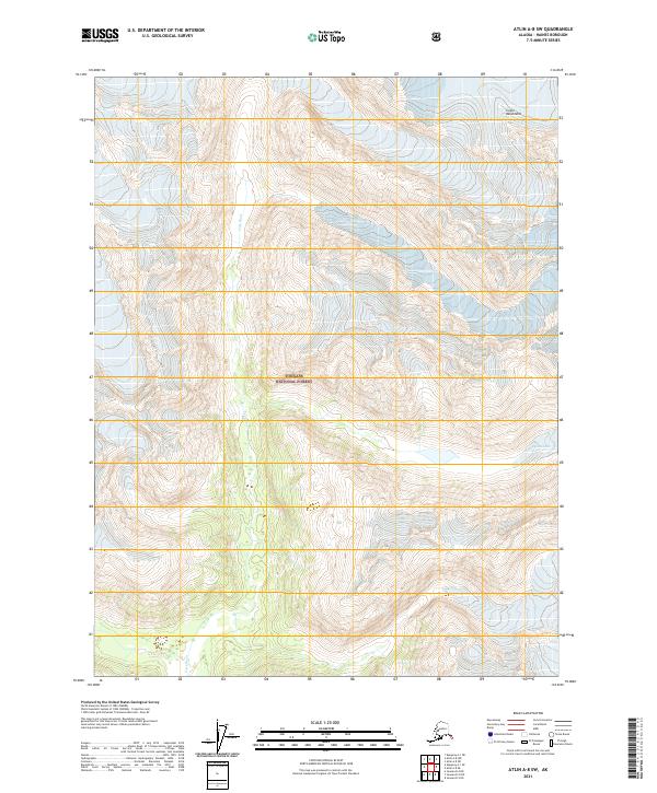
2021 Map of Atlin A-8 SW
USGS Topo · Published 2021About this map
Tongass National Forest dominates this section of the Alaskan wilderness, where the high peaks of the Coast Mountains meet glacial drainages. This recent survey documents a landscape defined by significant elevation changes and the dynamic flow of the Lace River, which meanders through a broad valley floor surrounded by steep, ice-carved topography. To the northeast, the Davies Glacier remains a primary geographic feature, its presence shaping the hydrology and drainage patterns of the region. The map provides a precise layout of the Public Land Survey System, including several township boundaries like t32s r62e and t33s r63e, which delineate these remote forest lands in the Haines Borough near the Canadian border.
Find a feature on this map
9 named features on this map. Tap any name to fly to it.
Don’t see what you’re looking for? This feature index may not catch every label — zoom into the map to look around manually.
Map Details
Editions of this 2021 Atlin A-8 SW Map
This is the sole edition of this map. No revisions or reprints were ever made.
Other maps of this area

1948 · Juneau D-3
USGS Topo · 1:63,360

1948 · Skagway A-1
USGS Topo · 1:63,360

1949 · Atlin
USGS Topo · 1:250,000

1949 · Juneau D-4
USGS Topo · 1:63,360

1949 · Juneau D-3
USGS Topo · 1:63,360

1951 · Juneau
USGS Topo · 1:250,000

1951 · Skagway A-1
USGS Topo · 1:63,360

1951 · Atlin
USGS Topo · 1:250,000

1951 · Juneau D-4
USGS Topo · 1:63,360

1952 · Skagway
USGS Topo · 1:250,000