
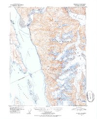
1951 Map of Skagway A-1
USGS Topo · Published 1952About this map
The maritime gateway of Southeast Alaska is defined here by the confluence of the Chilkoot Inlet and Chilkat Inlet, where the finger-like Chilkat Peninsula terminates at Seduction Point. In the early 1950s, this region was a critical navigational corridor within the Alaska-First Judicial Division, marked by the essential Battery Point Light guarding the approach to the upper canals. The landscape is dominated by the massive ice of the Meade Glacier in the northeast, feeding the silt-laden waters of the Katzehin River. Much of the territory falls within the Tongass National Forest, illustrating the vast wilderness management of the mid-century. From the heights of Sinclair Mtn to the small Taisani Islands and Sullivan Island in the Lynn Canal, the map reveals a complex system of fjords and peaks that dictated the patterns of coastal travel and transport.
Find a feature on this map
26 named features on this map. Tap any name to fly to it.
Don’t see what you’re looking for? This feature index may not catch every label — zoom into the map to look around manually.
Map Details
Editions of this 1951 Skagway A-1 Map
2 editions found
Other maps of this area

1948 · Juneau D-3
USGS Topo · 1:63,360

1948 · Skagway A-1
USGS Topo · 1:63,360

1949 · Atlin
USGS Topo · 1:250,000

1949 · Juneau D-5
USGS Topo · 1:63,360

1949 · Skagway B-1
USGS Topo · 1:63,360

1949 · Juneau D-4
USGS Topo · 1:63,360

1949 · Juneau D-3
USGS Topo · 1:63,360

1951 · Juneau
USGS Topo · 1:250,000

1951 · Atlin
USGS Topo · 1:250,000

1951 · Juneau D-4
USGS Topo · 1:63,360