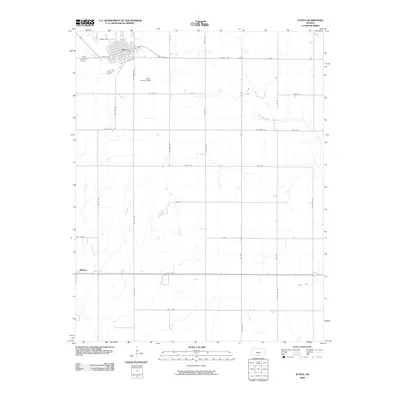
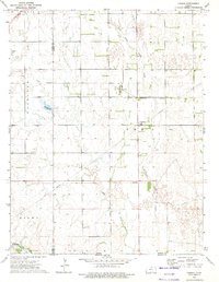
2009 Map of Attica
USGS Topo · Published 2009About this map
Attica serves as the primary hub of this Harper County landscape, organized around a traditional grid of streets such as Attica Ave and E York St. The town's local history is anchored by the Attica Cemetery to the west and the Attica Landing Field to the south, reflecting a community that balances agricultural roots with modern transportation. The surrounding terrain is defined by a dendritic network of waterways, including Bluff Creek and its tributary, West Branch Bluff Creek, which carve through the plains. Further south, the small settlement of Midway sits at the junction of State Hwy 2, illustrating the early 21st-century rural infrastructure. This map documents a region where local travel is facilitated by a strict section-line road system, from NW 100th Ave to NW 10 Rd, typical of the Kansas agricultural heartland.
Find a feature on this map
41 named features on this map. Tap any name to fly to it.
Don’t see what you’re looking for? This feature index may not catch every label — zoom into the map to look around manually.
Map Details
Editions of this 2009 Attica Map
This is the sole edition of this map. No revisions or reprints were ever made.
Other maps of this area

1889 · Anthony
USGS Topo · 1:125,000

1891 · Anthony
USGS Topo · 1:125,000

1955 · Pratt
USGS Topo · 1:250,000

1959 · Pratt
USGS Topo · 1:250,000

1972 · Attica
USGS Topo · 1:24,000
1972 · Anthony
USGS Topo · 1:24,000
1972 · Spring
USGS Topo · 1:24,000
1972 · Waldron
USGS Topo · 1:24,000
1972 · Corwin
USGS Topo · 1:24,000

1972 · Crisfield
USGS Topo · 1:24,000