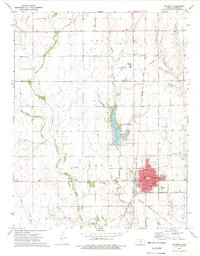
1972 Map of Anthony
USGS Topo · Published 1975About this map
Anthony serves as the focal point of this Harper County landscape, situated at a crossroads of mid-century regional transportation. The town's grid is anchored by essential civic structures including Lincoln School, Washington School, and the local Hospital. Outside the city limits, the Anthony Municipal Lake and Park provides a managed recreation area, while the rural surroundings are defined by the convergence of several waterways, most notably Bluff Creek, Spring Creek, and Rush Creek.
Find a feature on this map
26 named features on this map. Tap any name to fly to it.
Don’t see what you’re looking for? This feature index may not catch every label — zoom into the map to look around manually.
Map Details
Editions of this 1972 Anthony Map
2 editions found
Other maps of this area

1889 · Anthony
USGS Topo · 1:125,000

1889 · Caldwell
USGS Topo · 1:125,000

1891 · Anthony
USGS Topo · 1:125,000

1893 · Caldwell
USGS Topo · 1:125,000

1897 · Caldwell
USGS Topo · 1:125,000

1955 · Wichita
USGS Topo · 1:250,000

1955 · Pratt
USGS Topo · 1:250,000

1958 · Wichita
USGS Topo · 1:250,000

1959 · Pratt
USGS Topo · 1:250,000
1971 · Bluff City West
USGS Topo · 1:24,000