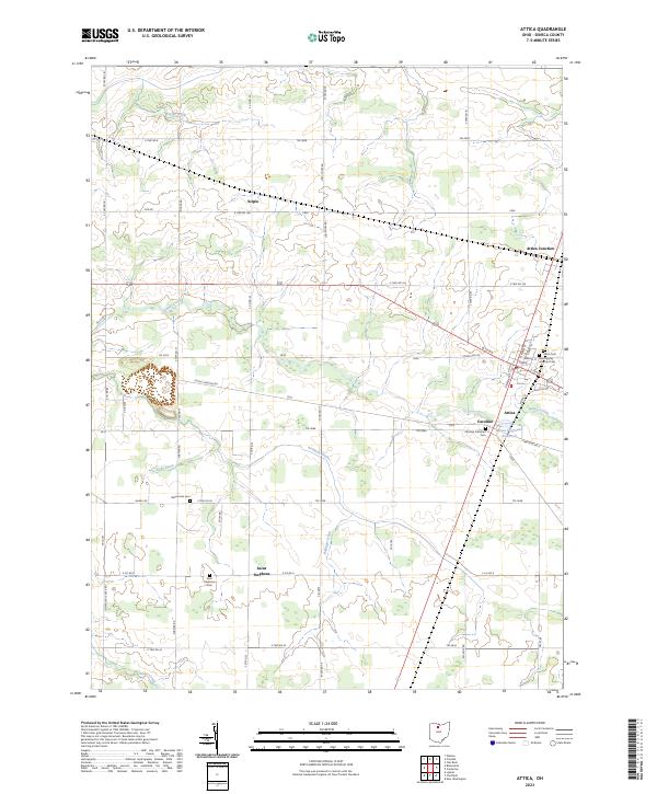
2023 Map of Attica
USGS Topo · Published 2023About this map
Attica serves as the primary hub in this portion of Seneca County, where the convergence of several local routes like W Tiffin and Stump Pike Rd defines the village's layout. The surrounding landscape is a detailed grid of agricultural roads and drainage systems, including Aichholz Ditch and Bollinger Ditch, which manage the water levels of this fertile region. Evidence of the area's religious and communal history is scattered throughout the rural townships, marked by several small burial grounds such as the Mennonite Cem near Marsh Rd and the Saint Stephens Cem in the settlement of Saint Stephens. Further north, Attica Junction indicates the historical importance of rail transit in connecting these agricultural communities. Natural water features like Honey Creek and Silver Creek wind through the terrain, while the Attica Reservoir provides a managed water source for the residents of Caroline and the nearby village.
Find a feature on this map
74 named features on this map. Tap any name to fly to it.
Don’t see what you’re looking for? This feature index may not catch every label — zoom into the map to look around manually.
Map Details
Editions of this 2023 Attica Map
This is the sole edition of this map. No revisions or reprints were ever made.
Other maps of this area

1906 · Sycamore
USGS Topo · 1:62,500

1906 · Tiffin
USGS Topo · 1:62,500

1915 · Siam
USGS Topo · 1:62,500

1915 · Bucyrus
USGS Topo · 1:62,500

1943 · Bucyrus
USGS Topo · 1:62,500

1950 · Marion
USGS Topo · 1:250,000

1956 · Toledo
USGS Topo · 1:250,000
1960 · Watson
USGS Topo · 1:24,000
1960 · Bloomville
USGS Topo · 1:24,000
1960 · Lykens
USGS Topo · 1:24,000