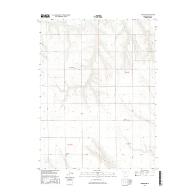
2015 Map of Atwood NW
USGS Topo · Published 2015About this map
The rolling plains of Rawlins County are defined here by the dual drainages of the N Fork Driftwood Cr and S Fork Driftwood Cr. This agricultural landscape, mapped by the U.S. Geological Survey in 2015, retains the geometric precision of the Public Land Survey System, with a dense network of section-line roads like Co Rd 407 and Co Rd Y connecting isolated homesteads. For genealogists and local historians, the presence of three distinct rural burial grounds—Saint Johns Cem, Enterprise Cem, and Immaculate Conception Cem—speaks to the early Catholic and pioneer communities that settled this corner of northwest Kansas. The terrain transitions from broad upland fields into the dissected draws surrounding the creek forks, where local routes like Field Trail Rd follow the natural topography of the High Plains.
Find a feature on this map
30 named features on this map. Tap any name to fly to it.
Don’t see what you’re looking for? This feature index may not catch every label — zoom into the map to look around manually.
Map Details
Editions of this 2015 Atwood NW Map
This is the sole edition of this map. No revisions or reprints were ever made.
Other maps of this area

1950 · Mc Donald
USGS Topo · 1:62,500

1951 · Mc Donald
USGS Topo · 1:62,500

1951 · Atwood
USGS Topo · 1:62,500

1954 · McCook
USGS Topo · 1:250,000

1954 · Goodland
USGS Topo · 1:250,000

1956 · Goodland
USGS Topo · 1:250,000

1957 · McCook
USGS Topo · 1:250,000

1957 · Goodland
USGS Topo · 1:250,000

1958 · McCook
USGS Topo · 1:250,000

1962 · Trenton SW
USGS Topo · 1:24,000