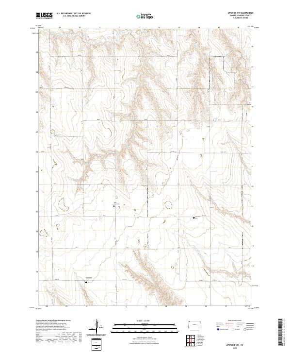
2022 Map of Atwood NW
USGS Topo · Published 2022About this map
Saint Johns Cem and Enterprise Cem anchor this section of Rawlins County, where the high plains landscape is defined by the winding paths of the N Fork Driftwood Cr and S Fork Driftwood Cr. The map reveals a strictly organized section-line road network, featuring routes such as Field Rd and Road W, which service the agricultural parcels throughout the T1S and T2S townships. This modern survey provides a detailed inventory of local landmarks essential for family history research, including the Immaculate Conception Cem located in the southern portion of the quadrangle. The drainage patterns of the Driftwood Creek forks suggest a terrain shaped by gradual erosion, creating the subtle breaks and draws that punctuate the otherwise level Kansas prairie.
Find a feature on this map
22 named features on this map. Tap any name to fly to it.
Don’t see what you’re looking for? This feature index may not catch every label — zoom into the map to look around manually.
Map Details
Editions of this 2022 Atwood NW Map
This is the sole edition of this map. No revisions or reprints were ever made.
Other maps of this area

1950 · Mc Donald
USGS Topo · 1:62,500

1951 · Mc Donald
USGS Topo · 1:62,500

1951 · Atwood
USGS Topo · 1:62,500

1954 · McCook
USGS Topo · 1:250,000

1954 · Goodland
USGS Topo · 1:250,000

1956 · Goodland
USGS Topo · 1:250,000

1957 · McCook
USGS Topo · 1:250,000

1957 · Goodland
USGS Topo · 1:250,000

1958 · McCook
USGS Topo · 1:250,000

1962 · Trenton SW
USGS Topo · 1:24,000