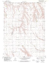
1978 Map of Atwood NW
USGS Topo · Published 1979About this map
Driftwood Oil Field and the surrounding high plains of Rawlins County define this landscape just south of the Nebraska state line in the late 1970s. The area is characterized by a mix of petroleum extraction and rural religious foundations, with numerous Oil Wells and a Drill Hole scattered across the undulating terrain. The drainage patterns of the North Fork Driftwood Creek and South Fork Driftwood Creek carve through the land, framed by the local regions of Burntwood and Beaver. The map is particularly useful for genealogists, as it preserves the locations of several important community sites including St Johns Ch, St Johns Cem, and the Immaculate Conception Cem. These features, alongside the Enterprise Cem, provide a clear picture of the historical settlement patterns in this remote corner of Kansas.
Find a feature on this map
15 named features on this map. Tap any name to fly to it.
Don’t see what you’re looking for? This feature index may not catch every label — zoom into the map to look around manually.
Map Details
Editions of this 1978 Atwood NW Map
This is the sole edition of this map. No revisions or reprints were ever made.
Other maps of this area

1950 · Mc Donald
USGS Topo · 1:62,500

1951 · Mc Donald
USGS Topo · 1:62,500

1951 · Atwood
USGS Topo · 1:62,500

1954 · McCook
USGS Topo · 1:250,000

1954 · Goodland
USGS Topo · 1:250,000

1956 · Goodland
USGS Topo · 1:250,000

1957 · McCook
USGS Topo · 1:250,000

1957 · Goodland
USGS Topo · 1:250,000

1958 · McCook
USGS Topo · 1:250,000

1962 · Trenton SW
USGS Topo · 1:24,000