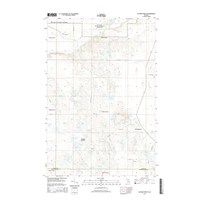
2014 Map of Au Sable Point SE
USGS Topo · Published 2014About this map
Pictured Rocks National Lakeshore occupies the northern reaches of this landscape, where the Hurricane River and De Mull Cr drain toward the coast. The interior is characterized by a dense network of glacial water bodies, including Grand Sable Lake, Moccasin Lake, and Bearfoot Lake. The area's mid-century recreational and residential character is visible at Sunrise Landing and Green Haven, while a series of Dams along the Fox River system suggests active water management within the forest. Transportation is defined by a mix of state highway M-77 and rugged back-country routes like Adams Trl and the Rhody Truck Trl, which provide access to the numerous isolated lakes such as Deadman Lake and Deerfoot Lake near the Alger and Schoolcraft County line.
Find a feature on this map
67 named features on this map. Tap any name to fly to it.
Don’t see what you’re looking for? This feature index may not catch every label — zoom into the map to look around manually.
Map Details
Editions of this 2014 Au Sable Point SE Map
This is the sole edition of this map. No revisions or reprints were ever made.
Other maps of this area

1931 · Seney NW
USGS Topo · 1:31,680

1931 · Driggs Lake NE
USGS Topo · 1:31,680

1931 · Driggs Lake NW
USGS Topo · 1:31,680

1954 · Sault Sainte Marie
USGS Topo · 1:250,000

1956 · Sault Sainte Marie
USGS Topo · 1:250,000

1957 · Sault Sainte Marie
USGS Topo · 1:250,000

1958 · Sault Sainte Marie
USGS Topo · 1:250,000

1958 · Marquette
USGS Topo · 1:250,000

1960 · Marquette
USGS Topo · 1:250,000

1961 · Marquette
USGS Topo · 1:250,000