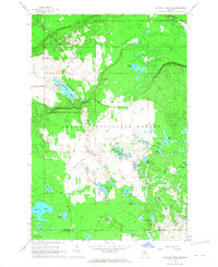
1966 Map of Au Sable Point SW
USGS Topo · Published 1968About this map
Pictured Rocks National Lakeshore dominates the northern boundary of this Upper Peninsula landscape, where the Hurricane River meets the Lake Superior shoreline. This 1966 survey captures a transitional period for the region's conservation and land use, showing the early boundaries of the national lakeshore adjacent to the expansive Grand Sable State Forest. The central portion of the map is defined by the Kingston Plains, a unique terrain peppered with numerous small water bodies including Kingston Lake, Evatt Lake, and Fishhook Lake.
Find a feature on this map
31 named features on this map. Tap any name to fly to it.
Don’t see what you’re looking for? This feature index may not catch every label — zoom into the map to look around manually.
Map Details
Editions of this 1966 Au Sable Point SW Map
2 editions found
Other maps of this area

1931 · Driggs Lake NE
USGS Topo · 1:31,680

1931 · Shingleton NE
USGS Topo · 1:31,680

1931 · Driggs Lake NW
USGS Topo · 1:31,680

1958 · Shingleton
USGS Topo · 1:62,500

1958 · Grand Portal Point
USGS Topo · 1:62,500

1958 · Marquette
USGS Topo · 1:250,000

1960 · Marquette
USGS Topo · 1:250,000

1961 · Marquette
USGS Topo · 1:250,000

1966 · Au Sable Point SE
USGS Topo · 1:24,000
1966 · Grand Sable Lake
USGS Topo · 1:24,000