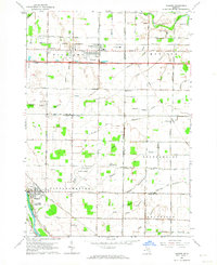
1962 Map of Auburn
USGS Topo · Published 1964About this map
The Tri-City Airport dominates the central landscape of this 1962 survey, serving as a modern aviation hub at the junction of Tittabawassee, Frankenlust, and Kochville townships. The map documents a rural transition where agricultural drains like McArthur Drain and Pine Drain neighbor growing infrastructure. Industrial history is visible in the coal Mine Dumps found along the New York Central Railroad near Auburn.
Find a feature on this map
64 named features on this map. Tap any name to fly to it.
Don’t see what you’re looking for? This feature index may not catch every label — zoom into the map to look around manually.
Map Details
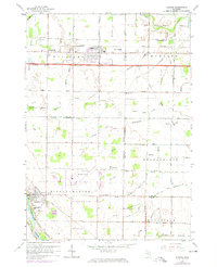
Editions of this 1962 Auburn Map
2 editions found
Other maps of this area

1916 · Bay City
USGS Topo · 1:62,500

1917 · St. Charles
USGS Topo · 1:62,500

1919 · Bay City
USGS Topo · 1:62,500

1919 · Saginaw
USGS Topo · 1:62,500

1941 · Saginaw
USGS Topo · 1:62,500

1943 · Bay City
USGS Topo · 1:62,500

1943 · Saginaw
USGS Topo · 1:62,500

1943 · St. Charles
USGS Topo · 1:62,500

1954 · Midland
USGS Topo · 1:250,000

1954 · Flint
USGS Topo · 1:250,000
Featured Places
- Auburn, MI
- Frankenlust Township, MI
- Kochville Township, MI
- Tittabawassee Township, MI
- Monitor Township, MI