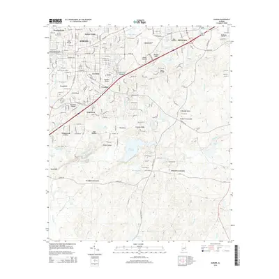
2014 Map of Auburn
USGS Topo · Published 2014About this map
The Auburn Univ Main Campus and the neighboring city of Opelika anchor this 2014 landscape, which balances dense academic and residential development with the riparian corridors of Lee County. The map documents the intricate growth of residential enclaves such as Shelton Woods, Forestdale, and Tanglewood, illustrating how the suburban footprint has expanded around the Interstate 85 corridor. To the south, the terrain transitions into a more hydrologically complex area centered on Chewacla State Park Lake and the winding Chewacla Creek.
Find a feature on this map
72 named features on this map. Tap any name to fly to it.
Don’t see what you’re looking for? This feature index may not catch every label — zoom into the map to look around manually.
Map Details
Editions of this 2014 Auburn Map
This is the sole edition of this map. No revisions or reprints were ever made.
Other maps of this area

1906 · Dadeville
USGS Topo · 1:125,000

1907 · Opelika
USGS Topo · 1:125,000

1909 · Opelika
USGS Topo · 1:125,000

1955 · Phenix City
USGS Topo · 1:250,000

1957 · Phenix City
USGS Topo · 1:250,000

1958 · Phenix City
USGS Topo · 1:250,000

1970 · Opelika East
USGS Topo · 1:24,000

1971 · Waverly
USGS Topo · 1:24,000

1971 · Parkers Crossroads
USGS Topo · 1:24,000

1971 · Little Texas
USGS Topo · 1:24,000