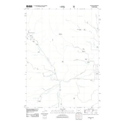
2011 Map of Auburn
USGS Topo · Published 2011About this map
Auburn sits at the edge of a high-mountain basin in Lincoln County, where the valley floor meets a complex network of canyons and ridges. This 2011 survey illustrates a landscape of working ranches and rugged terrain, anchored by the Auburn Cemetery and local landmarks like Petersons Ranch and Miller Ranch. The drainage of Stump Creek serves as the primary hydrological spine, fed by numerous tributaries such as Horse Creek and Cow Creek.
Find a feature on this map
41 named features on this map. Tap any name to fly to it.
Don’t see what you’re looking for? This feature index may not catch every label — zoom into the map to look around manually.
Map Details
Editions of this 2011 Auburn Map
This is the sole edition of this map. No revisions or reprints were ever made.
Other maps of this area

1915 · Freedom
USGS Topo · 1:62,500

1915 · Crow Creek
USGS Topo · 1:62,500

1921 · Afton
USGS Topo · 1:125,000

1949 · Stewart Flat
USGS Topo · 1:24,000

1951 · Stewart Flat
USGS Topo · 1:24,000

1955 · Preston
USGS Topo · 1:250,000

1958 · Preston
USGS Topo · 1:250,000

1962 · Preston
USGS Topo · 1:250,000
1980 · Grover
USGS Topo · 1:24,000
1980 · Thayne West
USGS Topo · 1:24,000