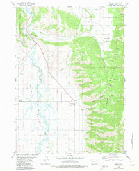
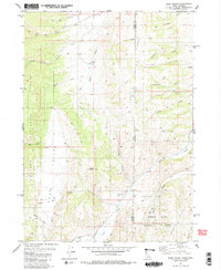
1980 Map of Grover
USGS Topo · Published 1980About this map
The Salt River winds through the floor of Star Valley, defining the fertile agricultural and ranching landscape of western Lincoln County. This 1980 survey reveals a quiet corridor of settlement along the eastern foothills of the Bridger National Forest and the western edge of the Caribou National Forest. Of particular historical significance is the Lander Cutoff (Emigrant Trail), which cuts northwest across the valley floor, tracing the path used by 19th-century pioneers bypassing more difficult mountain routes. Small communities like Grover and Auburn serve as local anchors, while Turnerville sits tucked against the timberline of the Salt River Range. The terrain transitions sharply from the level pastures near Stump Creek to the deeply incised drainages of Bradshaw Canyon and Jensen Canyon, reflecting the area's dual character of productive valley bottom and high mountain wilderness.
Find a feature on this map
40 named features on this map. Tap any name to fly to it.
Don’t see what you’re looking for? This feature index may not catch every label — zoom into the map to look around manually.
Map Details
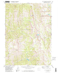
Editions of this 1980 Grover Map
This is the sole edition of this map. No revisions or reprints were ever made.
Other maps of this area

1915 · Freedom
USGS Topo · 1:62,500
1915 · Crow Creek
USGS Topo · 1:62,500

1921 · Afton
USGS Topo · 1:125,000

1955 · Preston
USGS Topo · 1:250,000

1958 · Preston
USGS Topo · 1:250,000

1962 · Preston
USGS Topo · 1:250,000
1980 · Man Peak
USGS Topo · 1:24,000
1980 · Thayne West
USGS Topo · 1:24,000
1980 · Sage Valley
USGS Topo · 1:24,000
1980 · Red Top Mountain
USGS Topo · 1:24,000