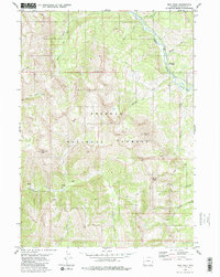
1980 Map of Man Peak
USGS Topo · Published 1980About this map
Greys River carves a deep valley through this high-elevation portion of the Bridger National Forest, defining the drainage patterns for numerous tributary creeks. The landscape is dominated by sharp summits, including Man Peak, Haystack Peak, and Virginia Peak, which reach above 9,000 feet. A network of Pack Trails provides the primary means of navigation through the steep terrain, connecting remote points like Indian Grave Flat and Sherman Peak. Historical land use is visible in the placement of the Moose Flat Campground along the river and various springs such as Strawberry Creek and Meadow Creek that feed into the larger water systems. The map reflects a period when the area was managed for both conservation and seasonal recreation, before significant modern infrastructure altered these back-country routes.
Find a feature on this map
26 named features on this map. Tap any name to fly to it.
Don’t see what you’re looking for? This feature index may not catch every label — zoom into the map to look around manually.
Map Details
Editions of this 1980 Man Peak Map
2 editions found
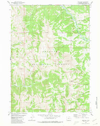
Other maps of this area

1921 · Afton
USGS Topo · 1:125,000

1931 · Jackson
USGS Topo · 1:125,000

1935 · Jackson
USGS Topo · 1:125,000

1955 · Driggs
USGS Topo · 1:250,000

1955 · Preston
USGS Topo · 1:250,000

1958 · Driggs
USGS Topo · 1:250,000

1958 · Preston
USGS Topo · 1:250,000

1962 · Driggs
USGS Topo · 1:250,000

1962 · Preston
USGS Topo · 1:250,000

1965 · Pickle Pass
USGS Topo · 1:24,000