
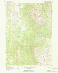
1965 Map of Pickle Pass
USGS Topo · Published 1967About this map
McCain Guard Station serves as a lone outpost in this 1960s survey of the high mountain terrain where the Teton National Forest and Bridger National Forest meet. The landscape is defined by the convergence of the Greys River and Little Greys River, with the massive spine of Grayback Ridge dominating the northern horizon. Movement through this wilderness is restricted to primitive paths such as the Pack Trail, Jeep Trail, and a Stock Driveway, indicating an economy based on seasonal grazing and forest management rather than permanent settlement.
Find a feature on this map
25 named features on this map. Tap any name to fly to it.
Don’t see what you’re looking for? This feature index may not catch every label — zoom into the map to look around manually.
Map Details
Editions of this 1965 Pickle Pass Map
2 editions found
Other maps of this area

1921 · Afton
USGS Topo · 1:125,000

1931 · Jackson
USGS Topo · 1:125,000

1935 · Jackson
USGS Topo · 1:125,000

1955 · Driggs
USGS Topo · 1:250,000

1955 · Preston
USGS Topo · 1:250,000

1958 · Driggs
USGS Topo · 1:250,000

1958 · Preston
USGS Topo · 1:250,000

1962 · Driggs
USGS Topo · 1:250,000

1962 · Preston
USGS Topo · 1:250,000
1965 · Bailey Lake
USGS Topo · 1:24,000